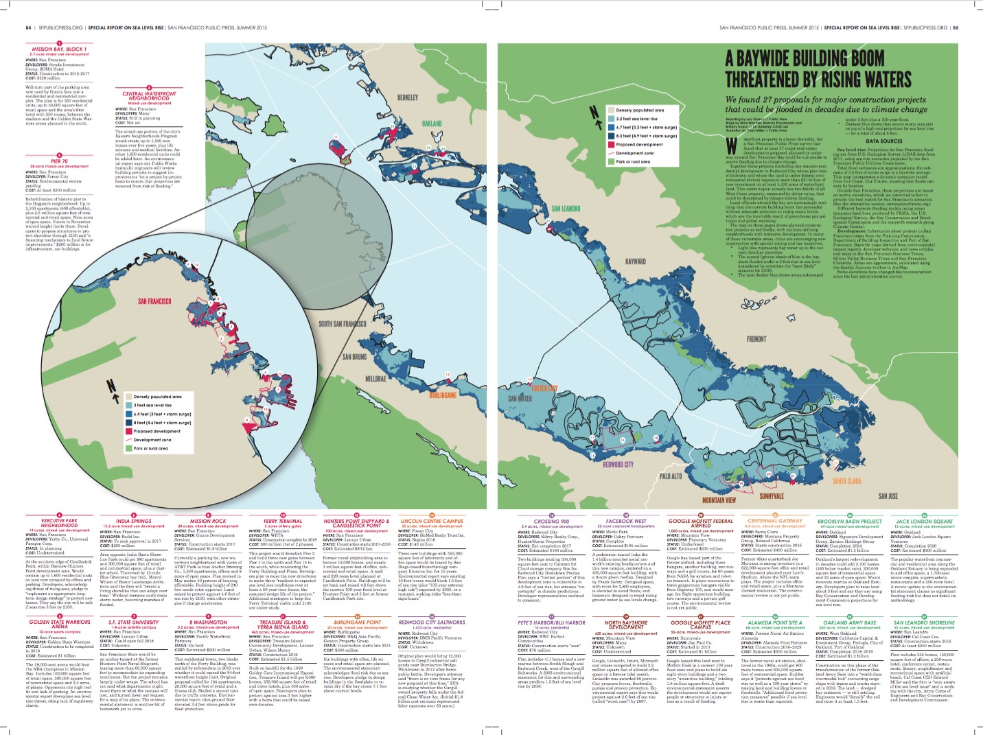
We found 27 proposals for major construction projects that could be flooded in decades due to climate change.
Full page view of interactive map
Map by Maia Wachtel, Marcea Ennamorato and Brittany Burson // UC Berkeley CAGE Lab; Amanda Hickman // Public Press
Waterfront property is always desirable, but a San Francisco Public Press survey has found that at least 27 major real estate developments proposed, planned or underway around San Francisco Bay could be vulnerable to severe flooding due to climate change.
Together these projects (including one massive residential development in Redwood City whose plan was withdrawn and where the land is under federal environmental review) represent more than $21 billion of new investment on at least 5,100 acres of waterfront land. This metro region already has two-thirds of all West Coast property, measured by dollar value, that could be threatened by climate-driven flooding.
Local officials around the bay are increasingly realizing that the current building boom has proceeded without adequate attention to rising ocean levels, which are the inevitable result of greenhouse gas pollution and global warming.
Our interactive map shows planned construction projects: In many of these vulnerable areas, cities are encouraging new construction with special zoning and tax incentives.
- Gray represents bay water up to the current, familiar shoreline.
- Dark blue shows a severe storm scenario on top of a high-end projection for sea level rise — for a total of about 8 feet.
To compare other sea level rise outcomes — including a 3-foot rise in sea level (considered by scientists the “most likely” scenario for 2100) — download a pdf of the map from our print edition, or order a copy of the newspaper.
Mission Bay, Block 1
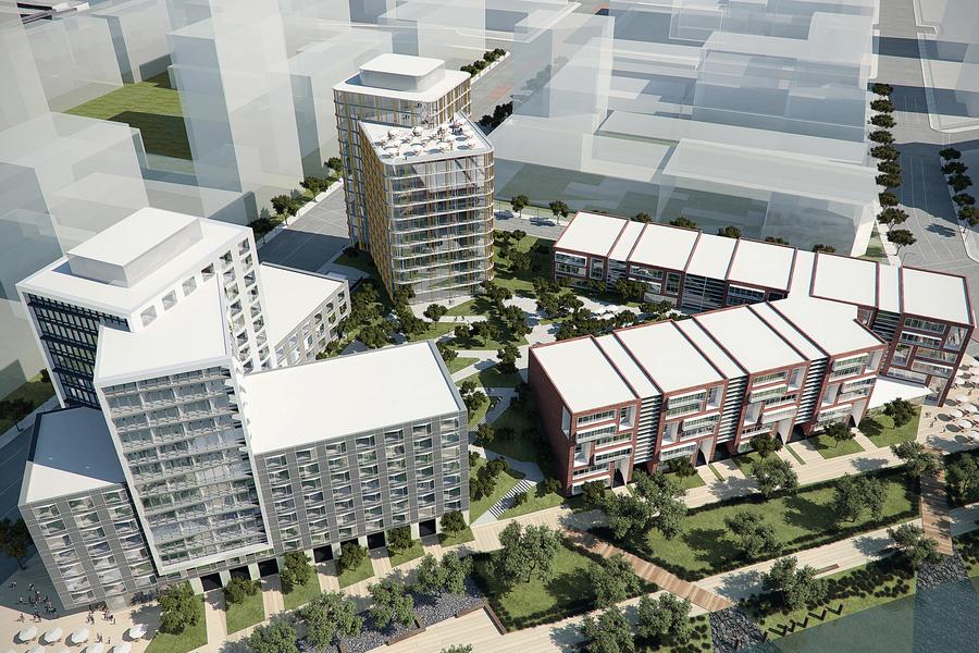
Photo courtesy of Stada Investment
2.7-acre mixed-use development (San Francisco)
DEVELOPERS: Strada Investment Group, SOMA Hotel | STATUS: Construction in 2015-2017 | COST: $220 million
Will turn part of the parking area now used by Giants fans into a residential and commercial complex. The plan is for 350 residential units, up to 50,000 square feet of retail space and the area’s first hotel with 250 rooms, between the stadium and the Golden State Warriors arena planned to the south.
Central Waterfront Neighborhood
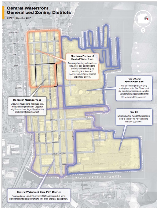
Photo courtesy of the City and County of San Francisco Planning Department
Mixed-use development (San Francisco)
DEVELOPERS: Many | STATUS: Still in planning | COST: Not set
The mixed-use portion of the city’s Eastern Neighborhoods Program would create up to 1,500 new homes over five years, plus life sciences and medical facilities. Another 1,600 residential units could be added later. An environmental report says city Public Works hydraulic engineers will review building permits to suggest improvements “on a project-by-project basis to ensure that properties are removed from risk of flooding.”
Pier 70
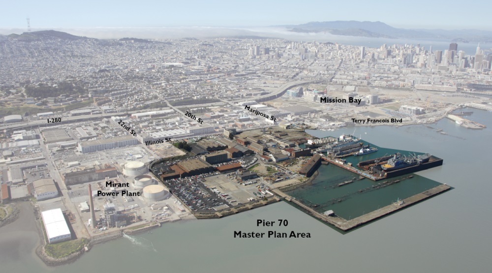
Photo courtesy of Pier 70: A Forest City Project
280 acre mixed-use development (San Francisco)
DEVELOPERS: Forest City | STATUS: Environmental review pending | COST: At least $200 million
Rehabilitation of historic pier in the Dogpatch neighborhood. Up to 2,100 apartments (600 affordable) plus 2.5 million square feet of commercial and retail space. Nine acres of open space. Voters in November waived height limits there. Developers to propose structures to protect shoreline through 2100 and “a financing mechanism to fund future improvements.” $200 million is for infrastructure, not buildings.
Executive Park Neighborhood
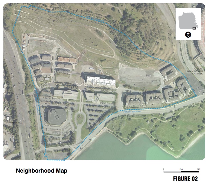
Photo courtesy of the City and County of San Francisco Planning Department
14 acres, mixed-use development (San Francisco)
DEVELOPERS: Yerby Co., Universal Paragon Corp. | STATUS: In planning | COST: Undetermined
At the southern edge of Candlestick Point, within Bayview-Hunters Point development zone. Would contain up to 1,600 residential units on land now occupied by offices and parking. Developers, acknowledging threat of rising seas, pledge to “implement an appropriate long-term design strategy” to protect new homes. They say the site will be safe if seas rise 3 feet by 2100.
Golden State Warriors Arena
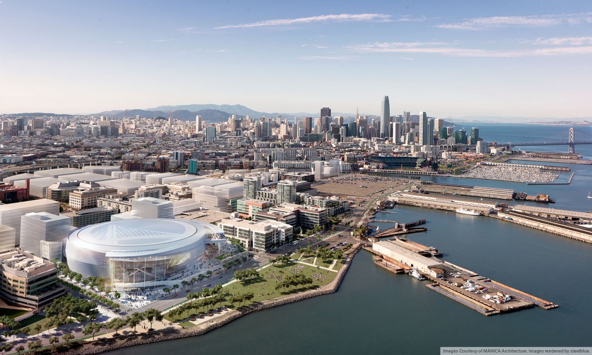
Photo courtesy of MANICA Architecture, images rendered by steelblue
12-acre sports complex (San Francisco)
DEVELOPERS: Golden State Warriors | STATUS: Construction to be completed in 2018 | COST:Estimated $1 billion
The 18,000-seat arena would host the NBA champions in Mission Bay. Includes 100,000 square feet of retail space, 500,000 square feet of commercial space and 3.2 acres of plazas. Opponents cite high traffic and lack of parking. An environmental report downplays sea level rise threat, citing lack of regulatory clarity.
India Springs
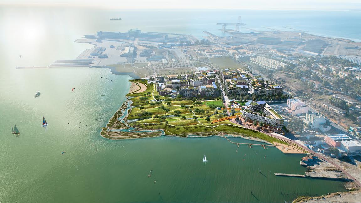
Photo courtesy of Build Inc
15.5-acre mixed-use development (San Francisco)
DEVELOPERS: Build Inc. | STATUS: To seek approval in 2017 | COST: $200 million
Area opposite India Basin Shoreline Park could get 980 apartments and 300,000 square feet of retail and commercial space, plus a charter school. Traversed by 13-mile Blue Greenway bay trail. Marcel Wilson of Bionic Landscape Architects said the firm will “create a living shoreline that can adapt over time.” Wetland terraces could drain storm water, becoming marshes if flooded.
S.F. State University

1.4-acre satellite campus (San Francisco)
DEVELOPERS: Lennar Urban | STATUS: Could open fall 2018 | COST: Unknown
San Francisco State would be an anchor tenant at the former Hunters Point Naval Shipyard, leasing more than 60,000 square feet to accommodate its expanding enrollment. But the project remains largely under wraps. The school has not said what departments might move there or what the campus will cost, and turned down our request for a map of its plans. The environmental statement is another bit of homework yet to come.
Mission Rock
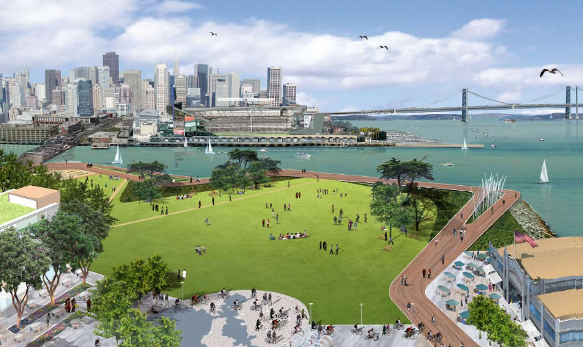
Photo courtesy of The Cordish Companies
28 acres, mixed-use development (San Francisco)
DEVELOPERS: Giants Development Services | STATUS: Construction starts 2017 | COST: Estimated $1.6 billion
Currently a parking lot, new waterfront neighborhood with views of AT&T Park to host Anchor Brewing Co., 1,500 apartments, offices and 8 acres of open space. Plan revised in May makes 40 percent of housing affordable. Building height of 240 feet needs voter approval. Land raised to protect against 4.6 feet of sea rise by 2100, with other strategies if change accelerates.
8 Washington
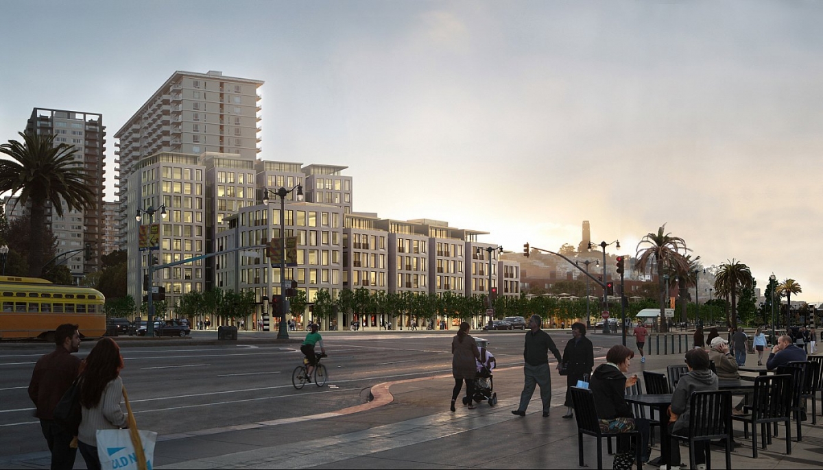
Photo courtesy of 8 Washington
3.2 acres, mixed-use development (San Francisco)
DEVELOPERS: Pacific Waterfront Partners | STATUS: On hold | COST: Estimated $200 million
This residential tower, two blocks north of the Ferry Building, was stalled by referendum in 2013 over whether it could exceed the 84-foot waterfront height limit. Original proposal called for 134 apartments, 20,000 square feet of retail and a fitness club. Stalled a second time due to traffic concerns. Environmental report cites ground floor elevated 3.4 feet above grade for flood protection.
Ferry Terminal
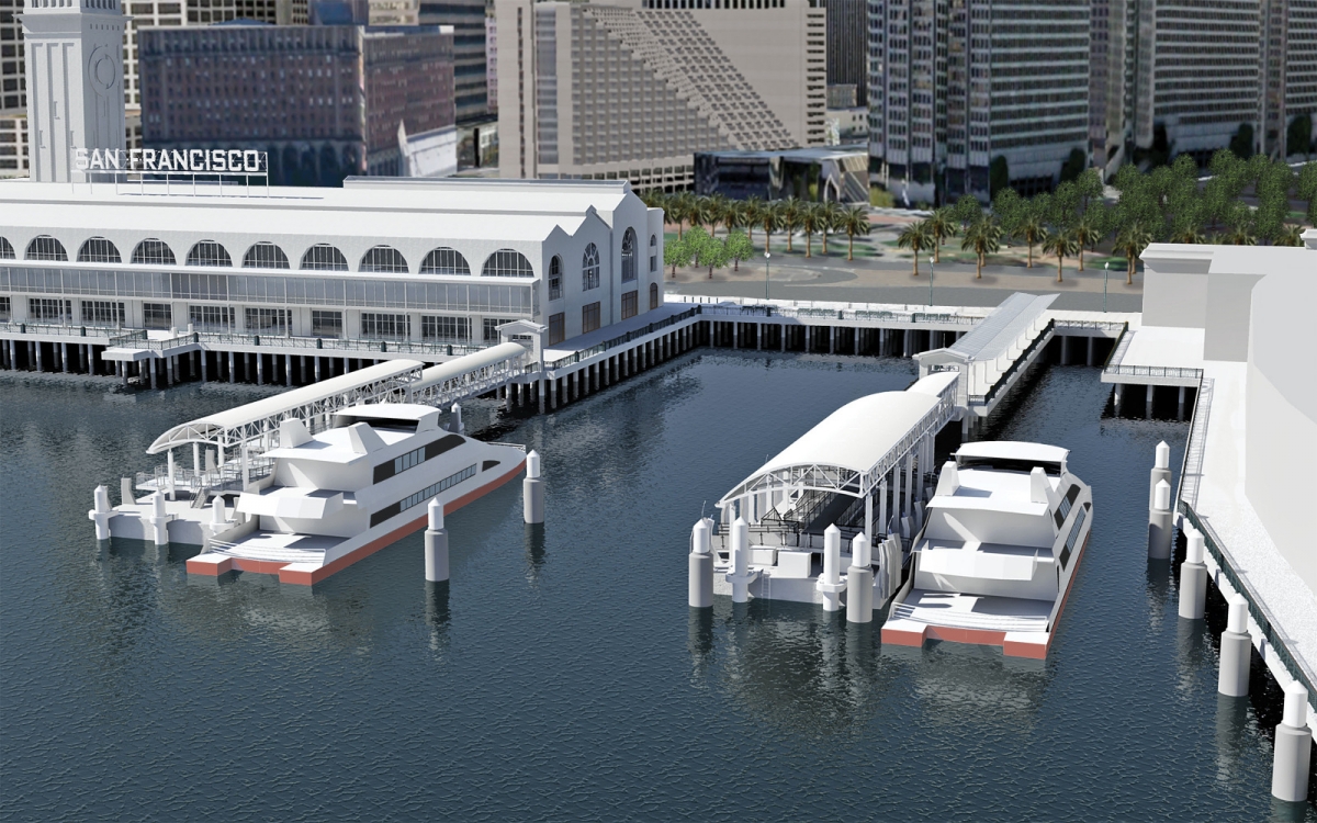
Photo courtesy of San Francisco Bay Ferry
3 acres of ferry gates (San Francisco)
DEVELOPERS: WETA | STATUS: Construction complete by 2018 | COST: $80 million (1st of 2 phases)
This project would demolish Pier 2 and build three new gates between Pier 1 to the north and Pier 14 to the south, while renovating the Ferry Building and Plaza. Developers plan to raise the new structures to make them “resilient to expected sea level rise conditions over at least a 50-year time frame, the assumed design life of the project.” Additional strategies to keep the Ferry Terminal viable until 2100 are under study.
Treasure Island & Yerba Buena Island
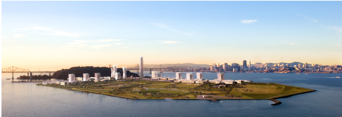
Photo courtesy of Treasure Island SF Bay
465 acres, mixed-use development (San Francisco)
DEVELOPERS: Treasure Island Community Development, Lennar Urban, Wilson Meany | STATUS: Construction 2016 | COST: Estimated $1.5 billion
Built on landfill for the 1939 Golden Gate International Exposition, Treasure Island will get 8,000 homes, 235,000 square feet of retail and three hotels, plus 300 acres of open space. Developers plan to protect against seas 3 feet higher with a berm that could be raised over decades.
Hunters Point Shipyard & Candlestick Point
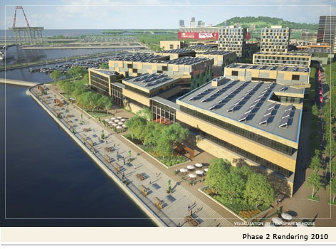
Photo courtesy of the City and County of San Francisco, Office of Community Investments and Infrastructures Hunters Point Shipyard
700 acres, mixed-use development (San Francisco)
DEVELOPERS: Lennar Urban | STATUS: Construction starts 2017-2018 | COST: Estimated $8 billion
Former naval shipbuilding area to become 12,000 homes, and nearly 3 million square feet of office, commercial and retail space. A mall and 220-room hotel planned at Candlestick Point. Buildings will be set back and raised 4.6 feet above the current 100-year flood level at Hunters Point and 3 feet at former Candlestick Park site.
Burlingame Point
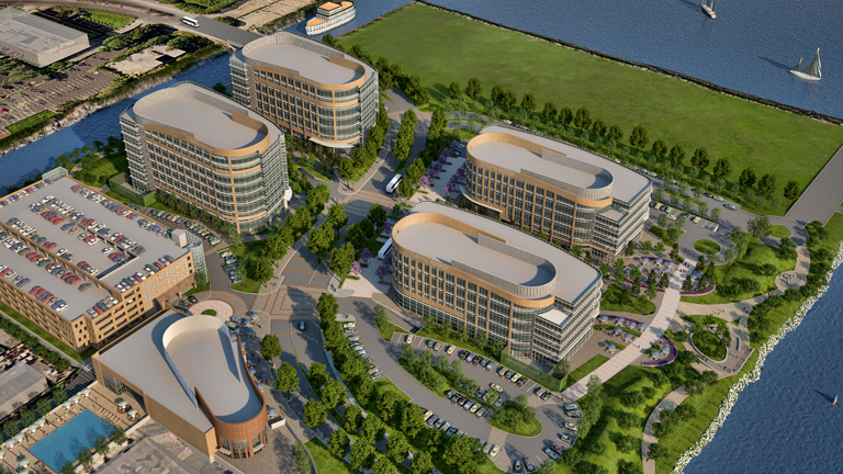
Photo courtesy of Burlingame Point
20 acres, mixed-use development (Burlingame)
DEVELOPERS: H&Q Asia Pacific, Genzon Property Group | STATUS: Construction starts late 2015 | COST: $300 million
Six buildings with office, life sciences and retail space are planned. The environmental statement acknowledges flood risk due to sea rise. Developers pledge to design buildings in the floodplain to remain dry if the bay crests 7.1 feet above current levels.
Lincoln Centre Campus
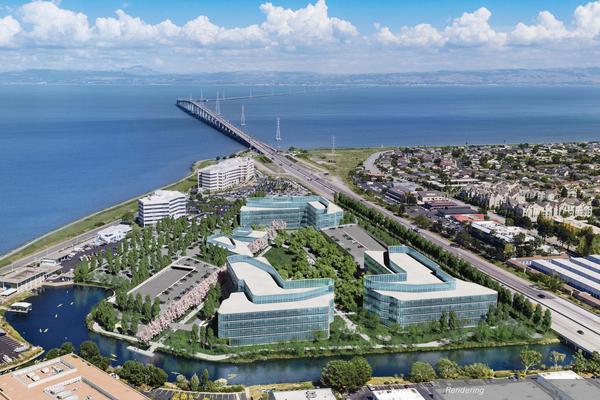
Photo courtesy of BioMed Realty Trust
20 acres, mixed-use development (Foster City)
DEVELOPERS: BioMed Realty Trust Inc. | STATUS: Begins 2016 | COST: Estimated $149 million
Three new buildings with 555,000 square feet of laboratory and office space would be leased by San Diego-based biotechnology company Illumina Inc. for 15 years. Environmental report says existing 10-foot levees would block 1.5 feet of sea rise (plus “100-year extreme high tide”) expected by 2050, or a tsunami, making risks “less-than-significant.”
Redwood City Saltworks
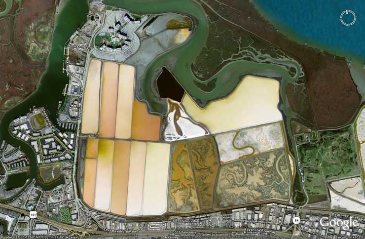
Photo courtesy of Google
1,433-acre, residential (Redwood City)
DEVELOPERS: DMB Pacific Ventures | STATUS: Withdrawn | COST: Unknown
Original plan would bring 12,000 homes to Cargill industrial salt ponds near Dumbarton Bridge. Withdrawn in 2012 after fierce public battle. Developer’s attorney said “there is no time frame for any new proposal at this time.” EPA is studying whether the Cargill-owned property falls under the federal Clean Water Act. (Initial $1.8 billion cost estimate represented labor expenses over 30 years.
Crossing 900
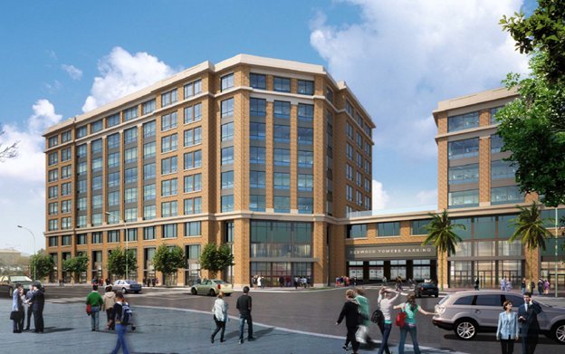
Photo courtesy of Hunter/Strom Properties
2.4 acres, mixed-use development (Redwood City)
DEVELOPERS: Kilroy Realty Corp., Hunter/Storm Properties | STATUS: Est. completion 2017 | COST: Estimated $180 million
Two buildings totaling 334,000 square feet next to Caltrain for Cloud storage company Box Inc. Redwood City Downtown Precise Plan says a “limited portion” of this development zone is vulnerable to 4.6 feet of sea rise, but stresses “uncertainty” in climate predictions. Developer representatives declined to comment.
Pete’s Harbor/ Blu Harbor
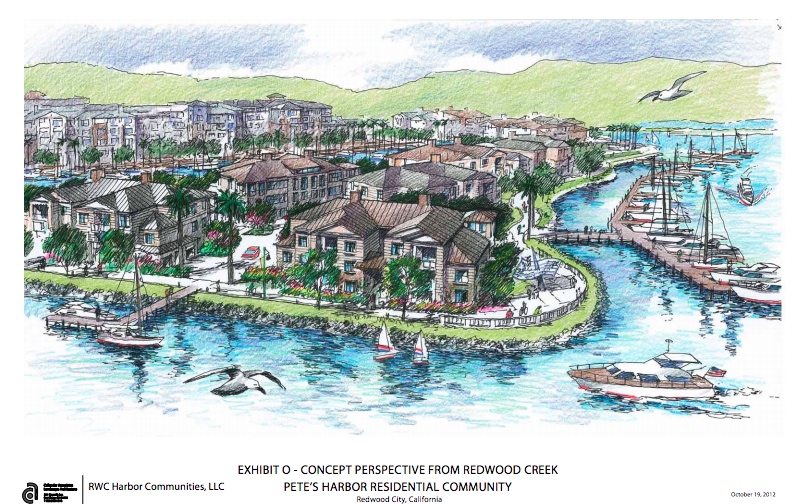
Photo courtesy of the Redwood City Planning Department
14 acres, residential (Redwood City)
DEVELOPERS: RWC Harbor Communities | STATUS: Construction starts “soon” | COST: $76 million
Plan includes 411 homes and a new marina between Smith Slough and Redwood Creek, west of the Cargill Saltworks. A 2003 environmental statement for this and surrounding areas predicts 1.3 feet of sea level rise by 2036.
Facebook West
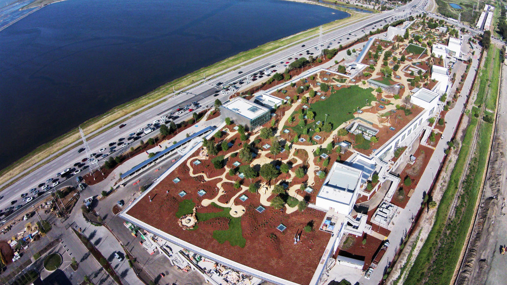
Photo courtesy of Matt Harnack / Facebook
22-acre corporate headquarters (Menlo Park)
DEVELOPERS: Gehry Partners | STATUS: Complete | COST: Estimated $185 million
A pedestrian tunnel links the 1.4 billion-member social network’s existing headquarters and this new campus, centered on a 430,000-square-foot building, with a 9-acre green rooftop. Designed by Frank Gehry. Occupied space, with room for 2,800 employees, is elevated to avoid floods, and basement designed to resist rising ground water as sea levels change.
North Bayshore Development
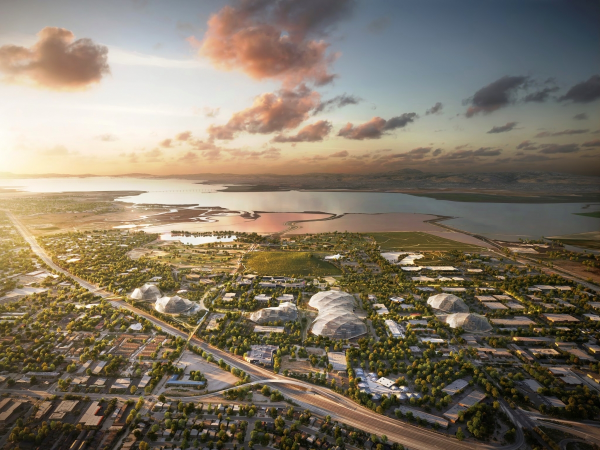
Photo courtesy of Google
650 acres, mixed-use development (Mountain View)
DEVELOPERS: Many | STATUS: Unknown | COST: Undetermined
Google, LinkedIn, Intuit, Microsoft and others competed to build 2.2 million square feet of allowed office space on a former tidal marsh. LinkedIn was awarded 60 percent. City proposes levees, floodwalls, pumps and erosion protection. Environmental report says this would protect against 2.6 feet of sea rise (called “worst case”) by 2067.
Google Moffett Federal Airfield
Photo courtesy of NASA
1,000 acres, mixed-use development (Mountain View)
DEVELOPERS: Planetary Ventures | STATUS: Undisclosed | COST: Estimated $200 million
Google has leased part of the former airfield, including three hangars, another building, two runways and a golf course, for 60 years from NASA for aviation and robotics research. It plans renovations to three gargantuan hangars visible from Highway 101, and would manage the flight operations building, two runways and a private golf course. The environmental review is not yet public.
Google Moffett Place Campus
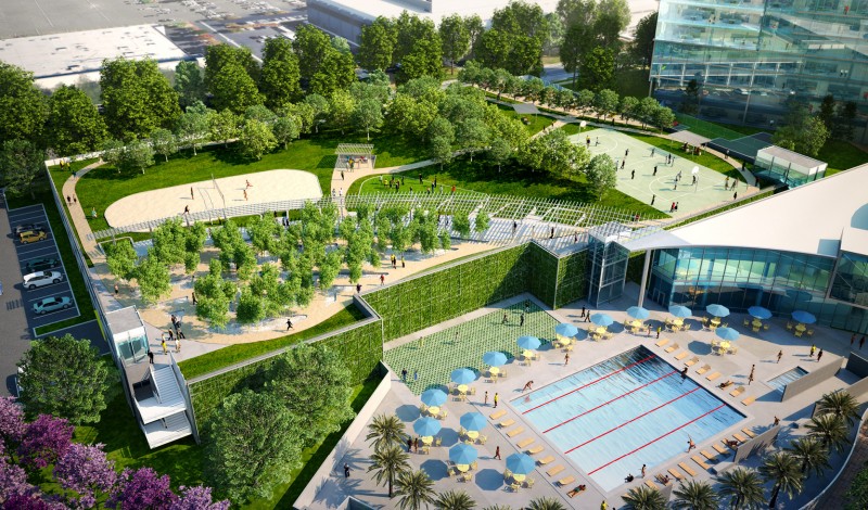
55-acre, mixed use development (Sunnyvale)
DEVELOPERS: Jay Paul Co. | STATUS: Started in 2013 | COST: Estimated $1 billion
Google leased this land next to Moffett Field in a current 100-year flood zone and plans to build six eight-story buildings and a two-story “amenities building,” totaling 1.8 million square feet. A draft environmental statement asserts the development would not expose people or structures to injury or loss as a result of flooding.
Centennial Gateway
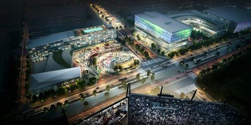
Photo courtesy of the Montana Property Group
8.4-acre, mixed-use development (Santa Clara)
DEVELOPERS: Montana Property Group, Related California | STATUS: Starts construction 2016 | COST: Estimated $400 million
Former 49ers quarterback Joe Montana is among investors in a 622,000-square-foot office and retail development planned near Levi’s Stadium, where the NFL team plays. The project includes office and retail space, plus a Montana-themed restaurant. The environmental review is not yet public.
Alameda Point Site A
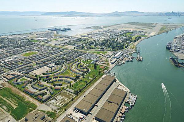
68-acre, mixed-use development (Former Naval Air Station Alameda)
DEVELOPERS: Alameda Point Partners | STATUS: Construction 2016-2029 | COST: Estimated $500 million
The former naval air station, shuttered in the 1990s, could get 800 more homes and 600,000 square feet of commercial space. Builder says it “protects against sea level rise as well as a 100-year storm” by raising land and building levees or floodwalls. “Additional flood protection measures” possible if sea level rise is worse than expected.
Brooklyn Basin Project
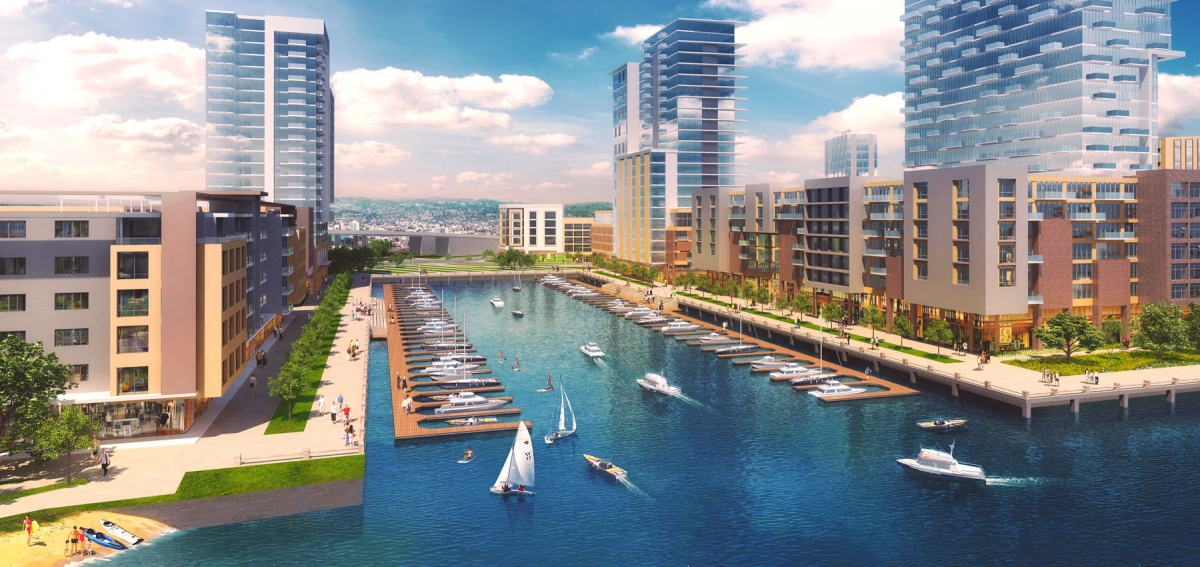
Photo courtesy of Signature Development Group
64-acre, mixed-use development (Oakland)
DEVELOPERS: Signature Development Group, Zarsion Holdings Group | STATUS: Completion 2024 | COST: Estimated $1.5 billion
Oakland’s largest redevelopment in decades could add 3,100 homes (465 below market rate), 200,000 square feet of commercial space and 32 acres of open space. Would renovate marina at Oakland Estuary. Developers plan to raise land about 3 feet and say they are using Bay Conservation and Development Commission projections for sea level rise.
Oakland Army Base
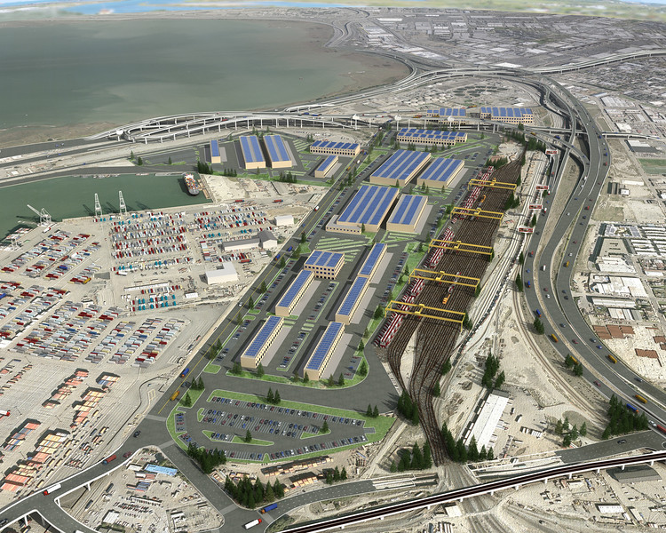
Photo courtesy of California Capital & Investment Group
360-acre, mixed-use development (West Oakland)
DEVELOPERS: California Capital & Investment Group, Prologis, City of Oakland, Port of Oakland | STATUS: Completion 2018-2019 | COST: Estimated $1.2 billion
Construction on this phase of the transformation of the former Oakland Army Base into a “world class intermodal hub” connecting cargo ships with trains and trucks started in 2013. The land — dredged bay sediment — is still settling. Engineers would “densify” the soil and raise it at least 1.3 feet.
Jack London Square
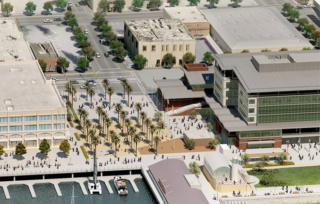
Photo courtesy of Ellis Partners LLC
12 acres, mixed-use development (Oakland)
DEVELOPERS: Jack London Square Ventures | STATUS: Completion 2020 | COST: Estimated $400 million
The popular waterfront commercial and residential area along the Oakland Estuary is being expanded to add office space, a 1,700-seat movie complex, supermarkets, restaurants and a 250-room hotel. A recent update to the environmental statement claims no significant flooding risk but does not detail its methodology.
San Leandro Shoreline
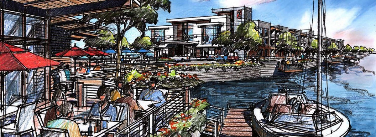
52 acres, mixed-use development (San Leandro)
DEVELOPERS: Cal Coast Cos. | STATUS: Construction starts 2016 | COST: At least $200 million
Plan includes 352 homes, 150,000 square feet of offices, a 200-room hotel, conference center, restaurants, library, amphitheater and recreational space with artificial beach. Cal Coast CEO Edward Miller said the firm is “very aware of the sea level issue” and is working with the city, Army Corps of Engineers and Bay Conservation and Development Commission.
Data Sources
Sea level rise: Projections for San Francisco flooding are from U.S. Geological Survey LiDAR data from 2011, using sea rise scenarios projected by the San Francisco Public Utilities Commission.
Total flood estimates are approximations; the estimate of 3.4 feet of storm surge is a baywide average. This map incorporates a dynamic computer model from Our Coast, Our Future, showing that floods can vary by location.
Outside San Francisco, these projections are based on metric elevations, which we converted to feet to provide the best match for San Francisco’s scenarios. (See the interactive version: ourcoastourfuture.org.)
Different bay-wide flooding models using ocean dynamics have been produced by FEMA, the U.S. Geological Survey, the Bay Conservation and Development Commission and the nonprofit research group Climate Central.
Development: Information about projects in San Francisco comes from the Planning Commission, Department of Building Inspection and Port of San Francisco. Baywide maps derived from environmental impact reports, developer websites, and news articles and maps in the San Francisco Business Times, Silicon Valley Business Times and San Francisco Chronicle. Areas are approximate, calculated using the Spatial Analysis toolbox in ArcMap. Some elevations have changed due to construction since the last aerial elevation survey.
